 This is a really super place to visit for a day, with Coventry Centre with its historic Cathedral and host of shops just a 500 yard walk away. It is about 6 miles from the Coventry Canal junction with the Oxford, and there being no locks so the diversion is quick and painless. There are mooring points in the basin and many more going North just beyond bridge 1. (Watersacape doesn’t list any overnight spots so I expect they are 24 hour.) It was particularly uncrouded when I visited the area in August 2009.
The basin is split into an inverted Y shape pointing North and contains a number of interesting features. There are 3 grade 2 listed buildings, the Canal Bridge, the Warehouses and the Canal House.
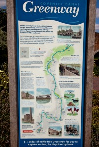
Leaving the basin and going North takes you along 5.1/2 miles of the Coventry Canal Greenway as mapped out on the left. This is, without doubt, a park with a number of art objects along the way to Hawkesbury Junction.
My photographic tour starts at the pedestrian entrance from the city at the West leg of the V then moves North. Continues starting at the South end of the second leg, each leg journey having an occasional look back to where we’ve been.
So here is a slideshow of the basin.
For more detailed information visit the BBC site.
You can receive emails notifying of pages added to the site – click here to set this up.