This stretch takes in Adderley Locks, Tyrely Locks, Norbury Junction, Gnosall and its wonderful Boat Inn, the area around Wheaton Aston, Stretton Aqueduct and Autherley Junction.
The current name Shropshire Union is a little misleading as most of it runs through Cheshire, a slight deviation into Shropshire at Audlem then a long section in Staffordshire and ending up in West Midlands. Nevertheless this stretch follows a largely rural farmland route with no obvious change of scenery. For more information click here.
That’s not to say that views from the canal are the same throughout – there are many deep cuttings with red rocks exposed; it must have been hard work for the navigators to dig out without powered tools.
Boaters are in for visual treats as they pass through the 40 miles, 24 locks and 78 bridges – so relatively flat. The road and farm bridges added so much to the navvy’s labours, but also to our enjoyment today.
It’s hard to cover the route as a non-boater and find all the gems of this canal stretch but I think extrapolations can be made from the photos I present here – I’m reliably informed by boaters met and boating acquaintances that there are many more visual gems along the route.
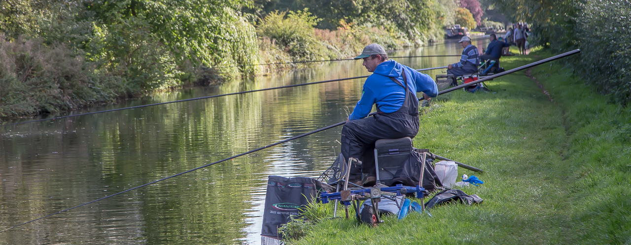
Just to show that the canals are for the enjoyment of all and that they all appreciate this, the photo below shows fishing enthusiasts on the run up to the Autherley Junction – there were about 10 in a space of 400 yards. They told me they need long rods like these because their personal presence on the towpath scares away the fish from nearby. So, they have to lift or retract the rods to allow walkers, boaters, runners and cyclists to pass. This happened several times while I passed and for many others as well as myself, with good grace shown by the anglers – just shows how the canals relax people! No rod rage here!
This is in a built up area in the north of the city of Wolverhampton – hard to believe!
Here is a slideshow of my photos, and below a Google map marked with the views mentioned in it stretching from Adderley Locks just south of Audlem to Autherley Junction, the southern end of the canal.
View Adderley Locks to Autherley Junction in a larger map