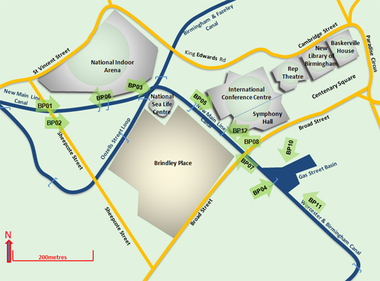
 Brindley Place, Birmingham canal map Post Code at centre of section is B1 2NX. Click here to open a Google Map of the area.
Total distance of .75km.
A canal photo trip through an area that was the heart of Britain’s metal bashing industry which showed the world how!
Now the once so successful factories have largely been razed to the ground and the areas redeveloped. In their place are equally successful new ventures such as the Brindley Place estate, the International Conference Centre (ICC) home of recent Labour and Conservative Party conferences, and Symphony Hall – all in the last 20 years.
You then return to the heritage area of Gas Street Basin, now a mooring place for resident boats and an area developed on a more traditional manner than the foregoing – very charming and atmospheric.
View slideshow and for the best effect expand the window to full screen view.
The best way to appreciate the splendid collection of canal aspects, bridges and buildings is through my “Paranormal Panoramic Perspective” slideshows. These have been included here from my contributions to another website that I author and control www.BrumCityCentre.com.
These are well worth viewing:
Ladywood Junction to Old Turn Junction
Old Turn Junction to Broad Street Tunnel
Gas Street Basin to The Mailbox
Old Turn Junction to Cambrian Wharf